Betty's Bay
| Betty's Bay Bettysbaai | |
|---|---|
 Betty's Bay | |
| Coordinates: 34°21′47″S 18°53′06″E / 34.363°S 18.885°E | |
| Naga | Afrika Borwa |
| Porofense | Kapa Bodikela |
| Mmasepala wa Selete | Overberg |
| Mmušôselegae | Overstrand |
| Hlômile | 1930 |
| Sekgôba[1] | |
| • Total | 20.99 km2 (8.10 sq mi) |
| Setšhaba (2011)[1] | |
| • Total | 1,380 |
| • Phitlaganyo | 66/km2 (170/sq mi) |
| Dipersente tša merafe (2011)[1] | |
| • Bathobaso | 3.7% |
| • Bammala | 21.1% |
| • MaIndia | 0.3% |
| • Makgowa | 72.6% |
| • Šele | 2.3% |
| Dipolelo tša ntlha (2011)[1] | |
| • Afrikaans | 60.5% |
| • Seisimane | 36.5% |
| • Šele | 3.0% |
| Nomoro ya poso (Setarata) | Molaô la pôsô |
| Nomoro ya poso (Lepokisi) | 7141 |
| Khoutu ya lefelo | 028 |
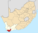
Betty's Bay ke toropo senyane wa Overberg coast go feta Kapa Bodikela, ka moka Afrika Borwa. Toropo e 96 km bohlabela la Cape Town[2]
Ditšhupetšo[lokiša | edit source]
- ↑ 1.0 1.1 1.2 1.3 "Main Place Betty's Bay". Census 2011.
- ↑ "Betty's Bay". Retrieved 2008-06-10.
- Ocean Blue Local Information Source, Maps, Links and Property
| Wikimedia Commons o na le mecha ea litaba tse amanang le ho Betty's Bay. |
Municipalities and communities of Mmasepala Setereke tša Overberg, Kapa Bodikela | ||
|---|---|---|
| District seat: Bredasdorp | ||
| Cape Agulhas | Arniston • Bredasdorp • Elim • L'Agulhas • Napier • Skipskop • Struisbaai • Suiderstrand |  |
| Overstrand | Baardskeerdersbos • Betty's Bay • Birkenhead • De Kelders • Fisherhaven • Franskraalstrand • Gansbaai • Hawston • Hermanus • Kleinbaai • Kleinmond • Onrusrivier • Pearly Beach • Pringle Bay • Rooi-Els • Sandbaai • Stanford • Van Dyks Bay • Vermont • Zwelihle | |
| Swellendam | Barrydale • Infanta • Malgas • Suurbraak • Swellendam | |
| Theewaterskloof | Botrivier • Caledon • Dennehof • Genadendal • Grabouw • Greyton • Riviersonderend • Villiersdorp | |

