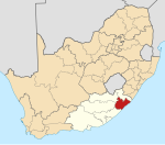
Ngqeleni
Appearance
| Ngqeleni | |
|---|---|
| Coordinates: 31°40′12″S 29°01′41″E / 31.670°S 29.028°E | |
| Naga | Afrika Borwa |
| Porofense | Kapa Bohlabela |
| Mmasepala wa Selete | O.R. Tambo |
| Mmušôselegae | Nyandeni |
| Sekgôba[1] | |
| • Total | 2.28 km2 (0.88 sq mi) |
| Setšhaba (2011)[1] | |
| • Total | 2,629 |
| • Phitlaganyo | 1,200/km2 (3,000/sq mi) |
| Dipersente tša merafe (2011)[1] | |
| • Bathobaso | 97.2% |
| • Bammala | 1.6% |
| • MaIndia | 0.3% |
| • Makgowa | 0.3% |
| • Šele | 0.5% |
| Dipolelo tša ntlha (2011)[1] | |
| • Sethosa | 87.4% |
| • Seisimane | 7.0% |
| • Sign language | 1.6% |
| • Sepedi | 1.1% |
| • Šele | 3.0% |
| Nomoro ya poso (Setarata) | 5140 |
| Nomoro ya poso (Lepokisi) | 5140 |
| Khoutu ya lefelo | 047 |
Ngqeleni ke toropo go feta Nyandeni Mmusogae, Mmasepala Setereke tša O.R. Tambo mo porofense Kapa Bohlabela (Eastern Cape) ka moka Afrika Borwa.
Ditšhupetšo
[lokiša | edit source]- ↑ 1.0 1.1 1.2 1.3 "Main Place Ngqeleni". Census 2011.
Bomasepala ba le metseng ea Mmasepala Setereke tša O.R. Tambo, Kapa Bohlabela. | ||
|---|---|---|
| District seat: Mthatha | ||
| Ngquza Hill | Flagstaff • Lusikisiki |  |
| Port St Johns | Port St Johns | |
| Nyandeni | Buntingville • Canzibe • Libode • Ngqeleni • Nomcamba | |
| Mhlontlo | Manzana • Qumbu • Tsolo | |
| King Sabata Dalindyebo | Coffee Bay • Mqanduli • Mthatha • Mvezo • Qunu | |

