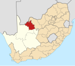
Cassel
Appearance
| Cassel 26°57′58″S 23°58′48″E / 26.966°S 23.980°E | |
|---|---|
| Naga | Afrika Borwa |
| Porofense | Kapa Leboa |
| Mmasepala wa Selete | John Taolo Gaetsewe |
| Mmušôselegae | Joe Morolong |
| Sekgôba[1] | |
| • Total | 4.95 km2 (1.91 sq mi) |
| Setšhaba (2011)[1] | |
| • Total | 3,895 |
| • Phitlaganyo | 790/km2 (2,000/sq mi) |
| Dipersente tša merafe (2011)[1] | |
| • Bathobaso | 98.4% |
| • Bammala | 0.8% |
| • MaIndia | 0.3% |
| • Šele | 0.5% |
| Dipolelo tša ntlha (2011)[1] | |
| • Setswana | 92.4% |
| • Seisimane | 1.6% |
| • Sezulu | 1.1% |
| • Šele | 4.9% |
| Nomoro ya poso (Setarata) | 8587 |
| Nomoro ya poso (Lepokisi) | 8587 |
Cassel ke village hleng mô wa Kuruman, toropo wa Mmušôgaê wa Ga-Segonyana, Mmasepala Setereke tša John Taolo Gaetsewe go feta diporofense Kapa Leboa ka moka Afrika Borwa.
Ditšhupetšo
[lokiša | edit source]- ↑ 1.0 1.1 1.2 1.3 "Main Place Cassel". Census 2011.
Bomasepala ba le metseng ea Mmasepala Setereke tša John Taolo Gaetsewe, Kapa Leboa | ||
|---|---|---|
| District seat: Kuruman | ||
| Joe Morolong | Cassel • Dithakong • Heuningvlei • Hotazel • Van Zylsrus |  |
| Ga-Segonyana | Bankhara • Gamopedi • Ga-Ntatelang • Havard • Kuruman • Magobe • Maheane • Mamoratwe • Maruping • Mothibistad • Ntsweng • Phakane • Sedibeng • Seodin | |
| Gamagara | Dibeng • Dingleton • Kathu • Olifantshoek | |
