Sutherland
Appearance
| Sutherland | |
|---|---|
 Top left: Fort Steenbok, a fortification from the Second Boer War. Top right: an aerial view of the South African Astronomical Observatory. Middle left: the main church in the town centre. Middle right: a view of the stars in the nights sky in Sutherland. Bottom: a panoramic view of the town centre facing away from the main church. | |
| Coordinates: 32°23′37″S 20°39′41″E / 32.39361°S 20.66139°E | |
| Naga | Afrika Borwa |
| Porofense | Kapa Leboa |
| Mmasepala wa Selete | Namakwa |
| Mmušôselegae | Karoo Hoogland |
| Hlômile | 1858 |
| Sekgôba[1] | |
| • Total | 35.98 km2 (13.89 sq mi) |
| Setšhaba (2011)[1] | |
| • Total | 2,836 |
| • Phitlaganyo | 79/km2 (200/sq mi) |
| Dipersente tša merafe (2011)[1] | |
| • Bathobaso | 8.0% |
| • Bammala | 78.2% |
| • MaIndia | 0.8% |
| • Makgowa | 12.7% |
| • Šele | 0.3% |
| Dipolelo tša ntlha (2011)[1] | |
| • Afrikaans | 96.0% |
| • Seisimane | 1.9% |
| • Šele | 2.1% |
| Nomoro ya poso (Setarata) | 6920 |
| Nomoro ya poso (Lepokisi) | 6920 |
| Khoutu ya lefelo | 023 |
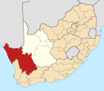
Sutherland ke toropo wa Mmušôgaê wa Karoo Hoogland go feta Mmasepala Setereke tša Namakwa ka moka Afrika Borwa.
Ditšhupetšo
[lokiša | edit source]- ↑ 1.0 1.1 1.2 1.3 "Main Place Sutherland". Census 2011.
Bomasepala ba le metseng ea Mmasepala Setereke tša Namakwa, Kapa Leboa | ||
|---|---|---|
| District seat: Springbok | ||
| Hantam | Brandvlei • Calvinia • Loeriesfontein • Nieuwoudtville |  |
| Kamiesberg | Garies • Hondeklip Bay • Kamieskroon • Karkams • Koingnaas • Leliefontein • Soebatsfontein • Spoegrivier | |
| Karoo Hoogland | Fraserburg • Sutherland • Williston | |
| Khâi-Ma | Aggeneys • Onseepkans • Pella • Pofadder | |
| Nama Khoi | Buffelsrivier • Concordia • Goodhouse • Grootmis • Henkries • Kleinzee • Komaggas • Nababeep • Okiep • Springbok • Steinkopf • Vioolsdrif | |
| Richtersveld | Alexander Bay • Eksteenfontein • Kuboes • Lekkersing • Port Nolloth • Sanddrif | |

