
Seswantšho:Localización de Melilla.png
Gago resolution ya go feta mo.
Localización_de_Melilla.png (306 × 204 pixel, bogolo ba faele: 4 KB, Mohuta wa MIME: image/png)
Kakaretšo
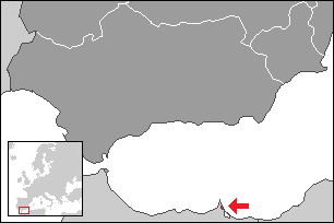
Map extent is fitted to NUTS ES3 area (Southern Spain).

|
File:Localización de Melilla.svg is a vector version of this file. It should be used in place of this PNG file when not inferior.
File:Localización de Melilla.png → File:Localización de Melilla.svg
For more information, see Help:SVG. |
 |
Laesense
I, the copyright holder of this work, hereby publish it under the following licenses:

|
Permission is granted to copy, distribute and/or modify this document under the terms of the GNU Free Documentation License, Version 1.2 or any later version published by the Free Software Foundation; with no Invariant Sections, no Front-Cover Texts, and no Back-Cover Texts. A copy of the license is included in the section entitled GNU Free Documentation License. |
| This file is licensed under the Creative Commons Attribution-Share Alike 3.0 Unported license. | ||
| ||
| This licensing tag was added to this file as part of the GFDL licensing update. |
You may select the license of your choice.
Histori ya faele
Pinyeletša go letšatšikgwedi/nako go bona faela ka tsela yeo ebego e le ka gona nakong yeo.
| LetšatšiKgwedi/Nako | Nkgogorupo-Nala | Bogolo | Mošomiši | Comment | |
|---|---|---|---|---|---|
| bjale | 08:36, 22 Phato 2015 | | 306 × 204 (4 KB) | Kontrollstellekundl | red dotted |
| 01:25, 26 Manthole 2009 |  | 306 × 204 (2 KB) | Martin H. | Reverted to version as of 08:09, 2 October 2006 | |
| 22:25, 25 Manthole 2009 |  | 250 × 189 (27 KB) | Vegggggggggggggg | {{Information |Description={{es|1=.}} |Source=. |Author=. |Date=. |Permission= |other_versions= }} | |
| 10:09, 2 Diphalane 2006 |  | 306 × 204 (2 KB) | Martorell | == Summary == Map extent is fitted to NUTS ES3 area (Southern Spain). Category:Spain Category:Maps of autonomous communities of Spain |
Tirišo ya Faele
Gago matlakala a hlomaganyago faeleng ye.
Global file usage
The following other wikis use this file:
- Usage on en.wikipedia.org