
Seswantšho:Location Andorra Europe.png

Size of this preview: 685 × 600 pixels. Other resolutions: 274 × 240 pixels | 548 × 480 pixels | 877 × 768 pixels | 1,170 × 1,024 pixels | 2,056 × 1,800 pixels.
''resolution'' ya gofella (2,056 × 1,800 pixel, bogolo ba faele: 447 KB, Mohuta wa MIME: image/png)
Wikimedia Commons

|
This locator map image could be re-created using vector graphics as an SVG file. This has several advantages; see Commons:Media for cleanup for more information. If an SVG form of this image is available, please upload it and afterwards replace this template with
{{vector version available|new image name}}.
It is recommended to name the SVG file “Location Andorra Europe.svg”—then the template Vector version available (or Vva) does not need the new image name parameter. |
Kakaretšo
| Description |
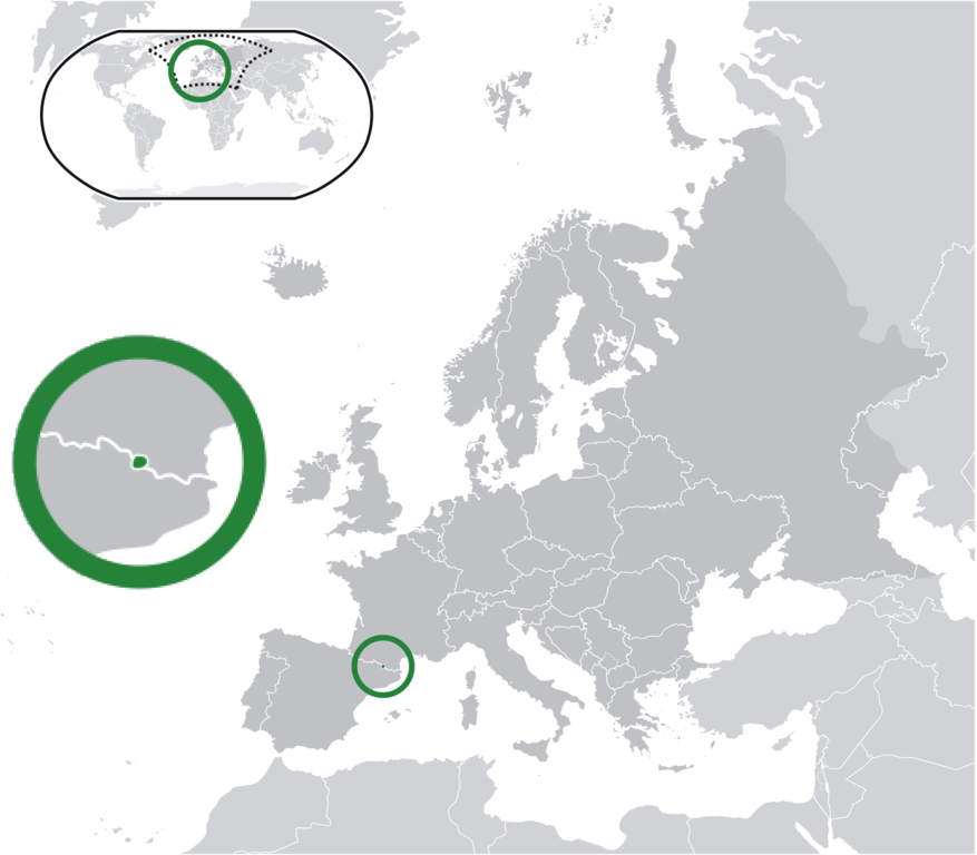
English: Andorra (dark green) / Europe (dark grey); inspired by and consistent with general country locator maps by User:Vardion, et al |
| Letšatšikgwedi | |
| Mothopo | Own work |
| Mongwadi | Bosonic dressing |
Laesense
I, the copyright holder of this work, hereby publish it under the following licenses:
This file is licensed under the Creative Commons Attribution-Share Alike 3.0 Unported license.
- You are free:
- to share – to copy, distribute and transmit the work
- to remix – to adapt the work
- Under the following conditions:
- attribution – You must give appropriate credit, provide a link to the license, and indicate if changes were made. You may do so in any reasonable manner, but not in any way that suggests the licensor endorses you or your use.
- share alike – If you remix, transform, or build upon the material, you must distribute your contributions under the same or compatible license as the original.

|
Permission is granted to copy, distribute and/or modify this document under the terms of the GNU Free Documentation License, Version 1.2 or any later version published by the Free Software Foundation; with no Invariant Sections, no Front-Cover Texts, and no Back-Cover Texts. A copy of the license is included in the section entitled GNU Free Documentation License. |
You may select the license of your choice.
Histori ya faele
Pinyeletša go letšatšikgwedi/nako go bona faela ka tsela yeo ebego e le ka gona nakong yeo.
| LetšatšiKgwedi/Nako | Nkgogorupo-Nala | Bogolo | Mošomiši | Comment | |
|---|---|---|---|---|---|
| bjale | 02:24, 2 Mosegamanye 2013 | | 2,056 × 1,800 (447 KB) | Klodde | Bigger |
| 04:55, 30 Phupu 2009 |  | 2,056 × 1,800 (370 KB) | Bosonic dressing | Andorra (dark green) / Europe (dark grey); inspired by and consistent with general country locator maps by User:Vardion, et al - correction | |
| 04:50, 30 Phupu 2009 |  | 2,056 × 1,800 (370 KB) | Bosonic dressing | {{Information |Description={{en|1=Andorra (dark green) / Europe (dark grey); inspired by and consistent with general country locator maps by User:Vardion, et al}} |Source=Own work by uploader |Author=Bosonic dressing |Date=29 Jun |
Tirišo ya Faele
Letlakala le ke latelago a hlomaganya go faele ye:
Global file usage
The following other wikis use this file:
- Usage on ady.wikipedia.org
- Usage on af.wikipedia.org
- Usage on ar.wikipedia.org
- أندورا
- بوابة:أندورا/واجهة
- بوابة:أندورا
- مستخدم:ElWaliElAlaoui/ملعب 8
- معاملة المثليين في أندورا
- مستخدم:جار الله/قائمة صور مقالات العلاقات الثنائية
- العلاقات الأندورية الأمريكية
- العلاقات الأندورية الأنغولية
- العلاقات الأندورية الكورية الجنوبية
- العلاقات الأندورية الإريترية
- العلاقات الأندورية السويسرية
- العلاقات الألمانية الأندورية
- العلاقات الأندورية الليختنشتانية
- العلاقات الأندورية البوليفية
- العلاقات الأندورية الموزمبيقية
- العلاقات الألبانية الأندورية
- العلاقات الأندورية البلجيكية
- العلاقات الأندورية الإثيوبية
- العلاقات الأندورية البيلاروسية
- العلاقات الأندورية الطاجيكستانية
- العلاقات الأندورية الروسية
- العلاقات الأندورية الرومانية
- العلاقات الأندورية الأرجنتينية
- العلاقات الأندورية الغامبية
- العلاقات الأندورية القبرصية
- العلاقات الأندورية السيراليونية
- العلاقات الأندورية النيبالية
- العلاقات الأندورية الليبيرية
- العلاقات الأندورية التشيكية
- العلاقات الأندورية الميانمارية
- العلاقات الأندورية الكندية
- العلاقات الأندورية السعودية
- العلاقات الأندورية الزيمبابوية
- العلاقات الأندورية الإسرائيلية
- العلاقات الأندورية المالية
- العلاقات الأندورية النيجيرية
- العلاقات الأندورية اليمنية
- العلاقات الأندورية الفانواتية
- العلاقات الأندورية الغابونية
- العلاقات الأندورية البنمية
- العلاقات الأندورية الكوبية
- العلاقات الأندورية الجورجية
- العلاقات الأندورية التونسية
View more global usage of this file.