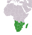
Seswantšho:Africa-countries-southern.png
Africa-countries-southern.png (360 × 392 pixel, bogolo ba faele: 10 KB, Mohuta wa MIME: image/png)
Histori ya faele
Pinyeletša go letšatšikgwedi/nako go bona faela ka tsela yeo ebego e le ka gona nakong yeo.
| LetšatšiKgwedi/Nako | Nkgogorupo-Nala | Bogolo | Mošomiši | Comment | |
|---|---|---|---|---|---|
| bjale | 21:02, 17 Hlakola 2018 |  | 360 × 392 (10 KB) | Maphobbyist | Montenegro border |
| 22:01, 9 Mosegamanye 2011 |  | 360 × 392 (13 KB) | Maphobbyist | South Sudan has become independent on July 9, 2011. Sudan and South Sudan are shown with the new international border between them. | |
| 13:13, 5 Mopitlo 2006 |  | 360 × 392 (4 KB) | Hautala | optimized with png | |
| 19:11, 28 Manthole 2004 |  | 360 × 392 (13 KB) | Maximaximax | countries of southern Africa (from en:) {{GFDL}} |
Tirišo ya Faele
Letlakala le ke latelago a hlomaganya go faele ye:
Global file usage
The following other wikis use this file:
- Usage on incubator.wikimedia.org
- Usage on mk.wikipedia.org
- Usage on oc.wikipedia.org
- Usage on pl.wiktionary.org
- Usage on ps.wikipedia.org
- Usage on pt.wikipedia.org
- Usage on ro.wikipedia.org
- Usage on rue.wikipedia.org
- Usage on ru.wikipedia.org
- Usage on sl.wikipedia.org
- Usage on sv.wikipedia.org
- Usage on sv.wikinews.org
- Usage on sw.wikipedia.org
- Usage on th.wikipedia.org
- Usage on tk.wikipedia.org
- Usage on tr.wikipedia.org
- Usage on tr.wiktionary.org
- Usage on uk.wikipedia.org
- Usage on uk.wiktionary.org
- Usage on ur.wikipedia.org
- Usage on vi.wikipedia.org
- Usage on wa.wikipedia.org
- Usage on wo.wikipedia.org
- Usage on zh.wikipedia.org


